
Image taken with DRAGO-2 of southern Turkmenistan, near the Caspian Sea, showing human infrastructure such as roads and a village, as well as the mountainous terrain of the area. Credit: IACTEC-Space / Google Earth
The DRAGO-2 instrument, developed by the Instituto de Astrofísica de Canarias (IAC) and launched in January from Cape Canaveral, has sent its first images of the Earth from space, showing a resolution six times better than that of its predecessor DRAGO-1.
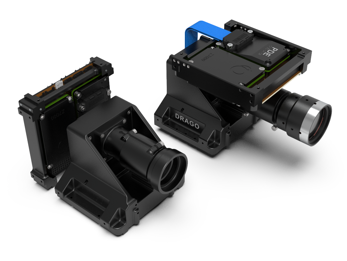
The space-borne camera DRAGO-2, (Demonstrator for Remote Analysis of Ground Observations), launched into space on January 4th, is the second instrument designed by IACTEC-Space. It observes in the short wavelength infrared, (acronym SWIR), a range invisible to the human eye, but nevertheless very useful for many studies and applications.
In the New Space sector, in which IACTEC-Space is working, more than half the missions fail. This team has achieved a second success in barely a few years. "Few teams in the world have done something similar, obtain such important goals in such a short time" declares Álex Oscoz, the Principal Investigator of the project
DRAGO-2 is the successor to DRAGO-1, which was placed in orbit in 2021, and the main improvement compared to its predecesor is the resolution of its camera. Alba Peláez, optical engineer at IACTEC-Space, explains that “DRAGO-2 has a different, and more complex objective lens, with a focus six times as long, which gives it much higher resolution”.
After its design, production, and complex testing by the IACTEC-Space team, DRAGO-2 was launched into space at the beginning of the year on a Falcon 9 rocket of the SpaceX company. The instrument is integrated into a satellite carrier ION-SCV 007 Glorious Gratia of the Italian D-Orbit company. Some days after launch, on January 17th, it made contact for the first time with the equipment on the ground, when the tests needed on all the subsystems were carried out, to show that it was working correctly.
Credit: IACTEC.
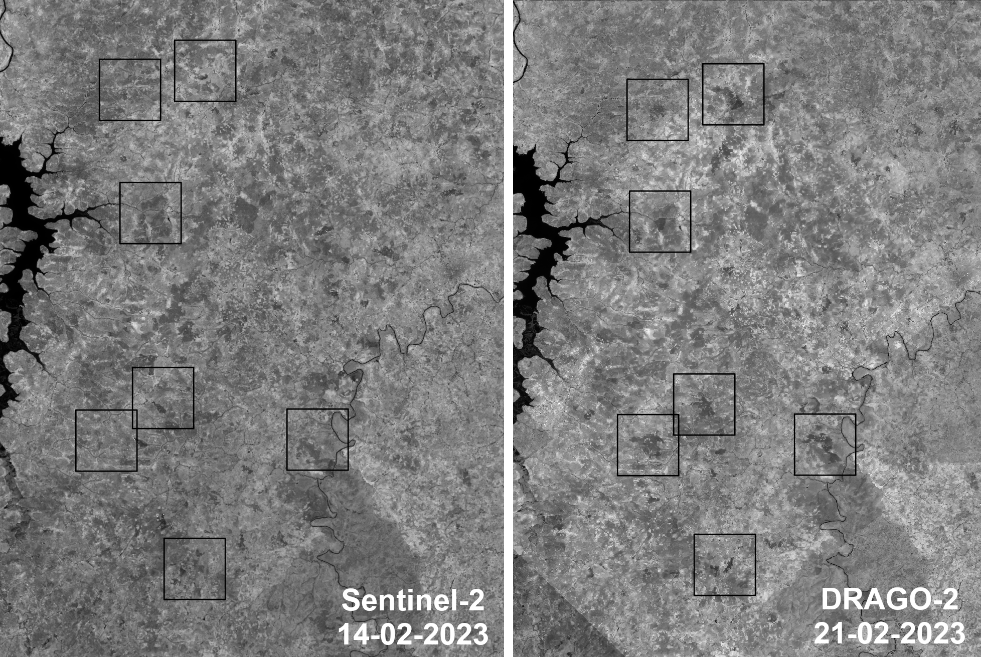
Finally on February 21st the first images with DRAGO-2 were taken. The first image published by the team corresponds to a zone in the country of Mali, a region characterized by scarcity of water and extreme heat, which increases the risk of forest fires. In fact, on DRAGO-2’s image new outbursts of fire are seen. They can be picked out more clearly when compared with images of preceding and following days taken by SENTINEL-2, a fleet of several large, latest generation satellites developed by the European Space Agency (ESA). “The orbit of DRAGO-2 does not coincide with the orbits of SENTINEL-2, which is a big advantage, because that way we can complement their images”, explains software engineer Ignacio Sidrach-Cardona.
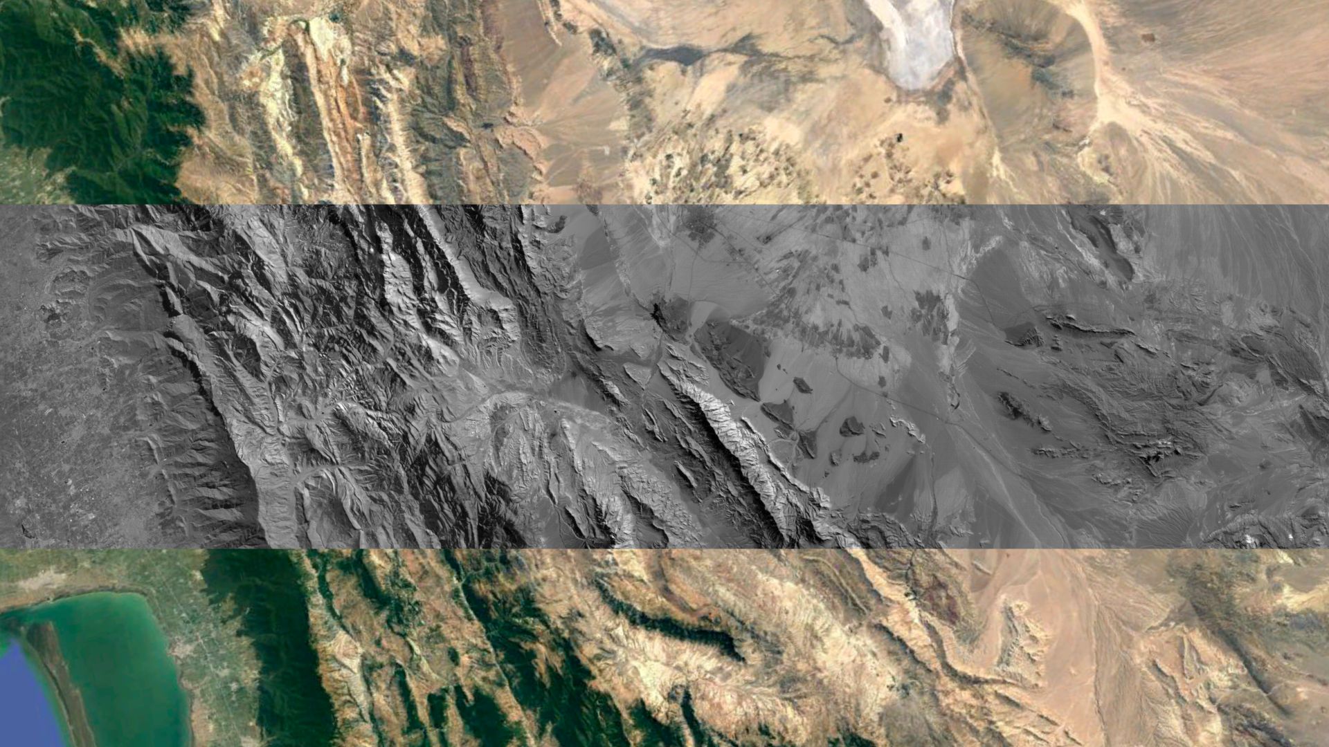
The region chosen for the second image taken by the infrared camera corresponds to a zone in the south of Turkmenistan, near the Caspian Sea. “It is a region with a very steep mountainous landscape, with high contrast, a real challenge for a camera of the size of DRAGO-2” explains optical engineer Xana Delpueyo. In spite of this in the image we can pick out human infrastructure, such as roads, and a village, as well as the mountains in the zone.
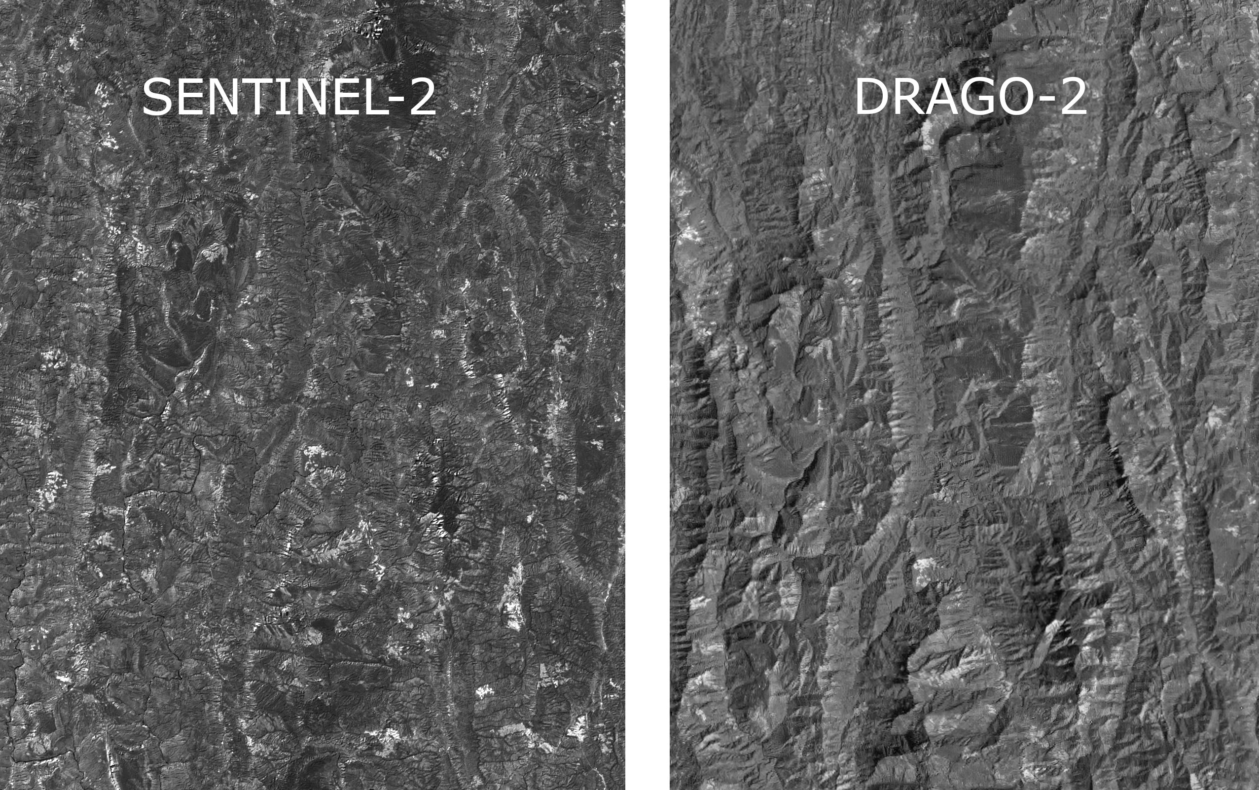
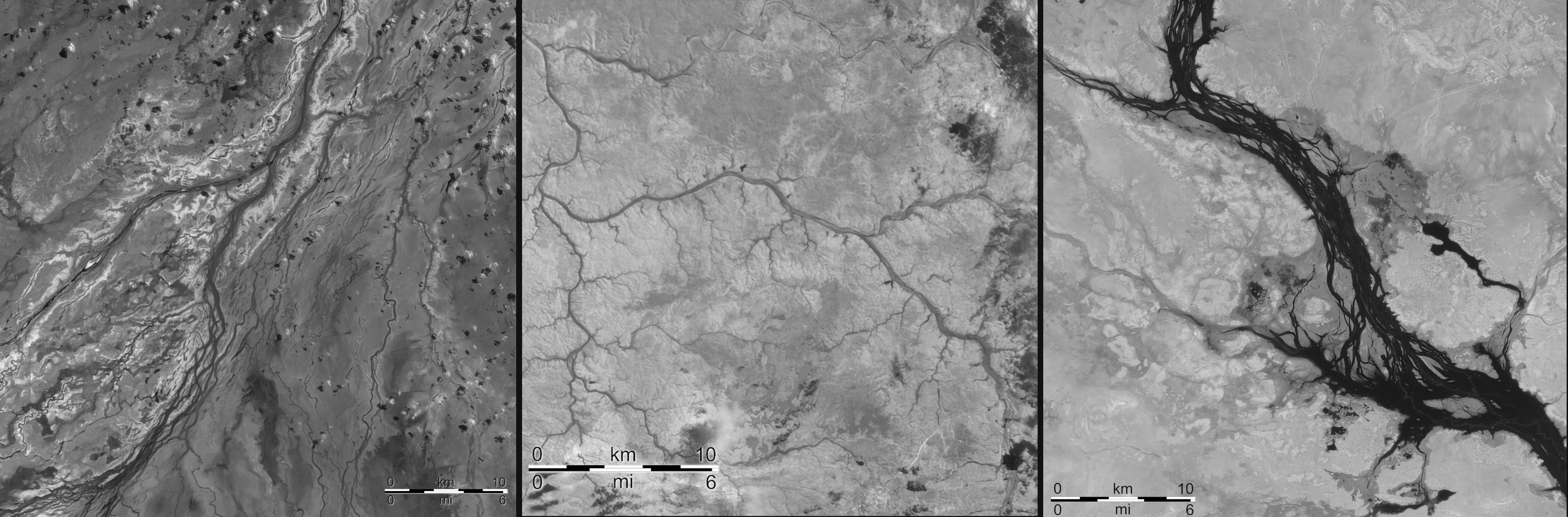
The next objective of the IACTEC-Space team, in the third image received, is of Mizorán, a state in the Republic of India. In this image we can clearly observe the high mountain landscape as well as its extensive vegetation. The fourth set of images corresponds to the State of Queensland in Australia. This is a zone with strong contrasts, in which we can pick out arid terrain in spite of the presence of seasonal rivers, which stand out powerfully in the infrared. Finally the fifth image corresponds to a zone in the east of Bangladesh, which was observed by DRAGO-1 two years ago during its demonstration mission, allowing us to compare the differences in the resolution between the images from the two instruments.
As indicated by Rafael Rebolo, Director of the IAC, “As we can prove, these first images from DRAGO-2 show very high quality and allow us to distinguish many different natural phenomena. All this points towards very promising future results and applications, among which are the application of techniques of super-resolution to the images from the camera, which allows us even to improve their quality”.
SMALL CAMERAS, BIG ACHIEVEMENTS
The DRAGO cameras are a new concept and focus in the observation of the Earth for scientific and social purposes. They weight about a kilogramme, and consume only 6 watts, comparable to a normal LED lamp. The development achieved by the IACTEC-Space team entails a cost and timing much reduced compared to other important space missions with similar aims, without affecting the final quality, as they can obtain very high resolution images. “Right now the DRAGO cameras are unique, because we are observing in a spectral range not used by any other small satellite”, explains electronic engineer José Carlos Sanluis.
These infrared cameras are used to monitor fires, volcanic activity, hydrocarbon spills, and to observe desertification and humidity in crops, among other possibilities. Their images will allow the development of plans to prevent natural catastrophes and to act against them.
DRAGO-2 does not substitute but complements its predecesor DRAGO-1, because they can be used for different cases, depending on the size of the event for which monitoring is needed. Carlos Colodro, electronic engineer at IACTEC-Space explains that “DRAGO-1 is better suited to make large scale studies, for example studies of the evolution of clouds or desert dust clouds, while studies of the state of cultivated pieces of land, or damage caused by a natural catastrophe, to give two examples, require the use of DRAGO-2".
The work of the IACTEC-Space team has not finished with the success of the DRAGO camera. One of the next projects on which they are working is ALISIO-1 (Advanced Land-Imaging Satellite for Infrared Observations). This will be the first Canary satellite to be placed in orbit by the Instituto de Astrofísica de Canarias in 2024, and will carry another DRAGO-2 camera, as well as a module to send information between the ground and space with a laser beam. “The ALISIO-1 mission will not only allow us to obtain images autonomously with the DRAGO-2 instrument, but has also set the groundwork for us to tackle more complex missions, such as IACSAT-1, the future first space telescope of the Instituto de Astrofísica de Canarias”, adds Alfonso Ynigo, systems engineer on the project.
IACTEC-Space, led by IAC researcher Álex Oscoz, is a programme integrated into IACTEC, the area of technological and business collaboration of the IAC, which has financial support- Training Programme supported by the TFINNOVA Programme,in the Strategic Framework for Island Development (MEDI) and the Development Fund of the Canaries- and of infrastructures (IACTEC building), of the Cabildo Insular of Tenerife. IACTEC.Space is funded by the Plan for Recovery, Transformation, and Resilience of the Gocernmeent of Spain, and by the Centre for Technological Development and Innovation (CDTI).
Images and videos (link)
More information: IACTEC-Space website
Contact at the IAC:
- Patricia Chinchilla: pcg [at] iac.es (pcg[at]iac[dot]es)
- Álex Oscoz: alex.oscoz [at] iac.es (alex[dot]oscoz[at]iac[dot]es)


")


, held at the IACTEC and IAC facilities.")

