Related grants:
General
IACTEC-Space is the project within IACTEC that drives innovation and development related to the use of small satellite payloads and satellite instrumentation. Our main task is the design and development of small satellite payloads. We have several ongoing projects, in different completion phases:
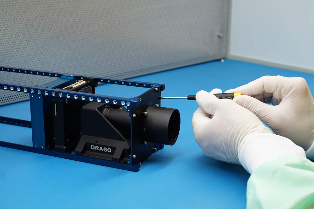
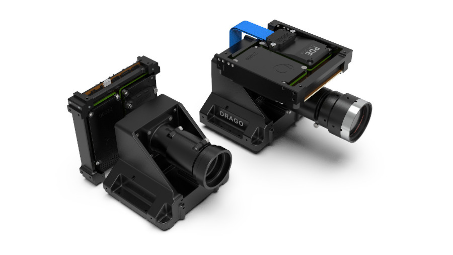
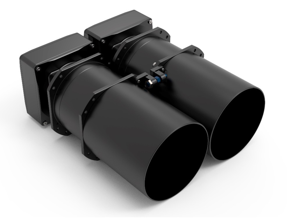
The DRAGO SWIR cameras
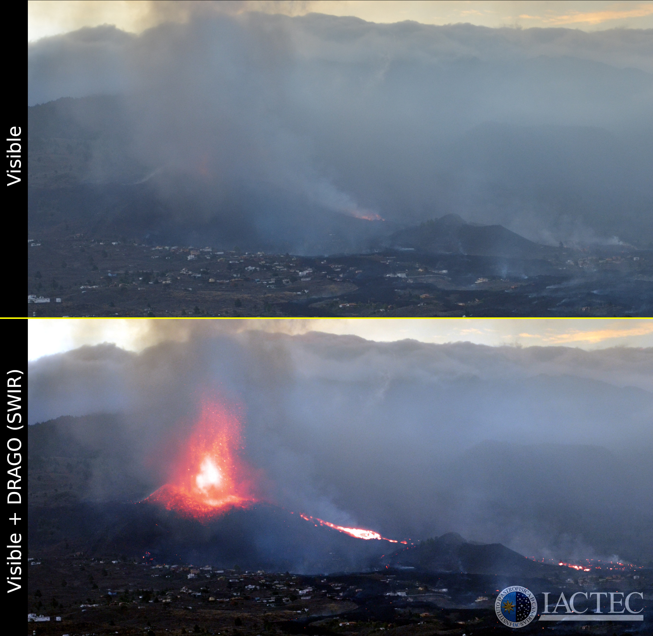
Our first instruments, the DRAGO cameras for Earth Observation, observe in the short-wave infrared (SWIR), between 1.0 and 1.7 microns. Their compact size, low weight and low power consumption makes them perfect for microsatellites. The cameras, DRAGO-1 and DRAGO-2, were sent to space in 2021 and 2023 respectively, and showed their amazing performance in their demonstration missions.
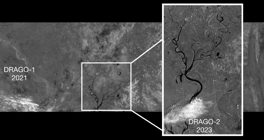
DRAGO-1 has a field of view of 190 km and a resolution of 300 m per pixel, for an orbit of 500 km. On the other hand, DRAGO-2 has a smaller field of view, of 32 km, but a higher resolution: 50 m per pixel, for the same orbit. Therefore, these two cameras are complementary in field of view and resolution, and among their possible uses are fire monitoring, volcanic activity monitoring, oil spills detection, desertification analysis, water stress monitoring in crops, etc.
These cameras are quite unique in that they include patent-pending technology that allows them to be used in space without an active cooling system, saving up to 60% of their power consumption. The camera incorporates infrared optics developed, in collaboration with IACTEC-Espacio, by the Spanish company ASEOptics, who also developed the optics of the predecessor DRAGO-2. In terms of data management, the cameras can compress the images, with and without loss, they have encryption and decryption capabilities, and they also include super-resolution algorithms that enable higher-quality image acquisition, combining exposures taken with small sub-pixel shifts.
Building on a solid technological legacy and the experience gained from previous developments, the IAC takes a new step in the evolution of its space instrumentation with the DRAGO-3 project. This new version of the infrared detector introduces significant improvements over its predecessor, DRAGO-2, particularly in terms of resolution, sensitivity, and thermal stability. In addition, it features a design optimized for integration into satellite constellations, enabling greater modularity and operational flexibility.
The main objective of DRAGO-3 is to enhance observation capabilities in the near-infrared spectrum, providing more accurate and reliable data from space. Its advanced design will support the development of more efficient and adaptable missions, aligned with emerging trends in multi-satellite platforms. With its enhanced technical performance, DRAGO-3 becomes a key tool for scientific, environmental, and security missions, delivering high-quality imagery that contributes to better understanding of the planet and more effective responses to critical situations.
This technological development is targeted at a wide range of strategic sectors. Scientific and academic institutions can use DRAGO-3 for remote sensing studies, geology, water resource management, and climate change research. Government agencies will benefit from its capabilities for environmental monitoring and disaster response. Companies in the aerospace and energy sectors may apply its features to terrestrial monitoring, precision agriculture, and infrastructure control. Finally, emergency and security services can use it for surveillance of strategic areas and early detection of anomalous activities.
The DRAGO cameras are fully developed and available for any institution or company that requires them. You can find more information and images of the DRAGO cameras here:
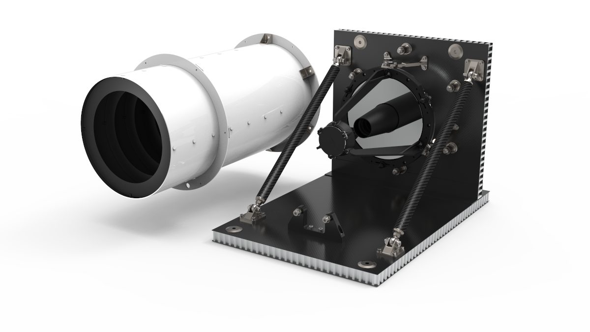
The IACSAT Astro-1 Space Telescope
IACSAT Astro-1 will be the first space astronomical observatory of the Instituto de Astrofísica de Canarias, which will be used for the confirmation of new Earth-like exoplanets and the study and monitorization of near-Earth asteroids. It will consist on a ~22 cm mirror telescope, operating in the visible and near-infrared. This telescope is currently under development.
You can find more information about the IACSAT Astro-1 space telescope here:
VINIS payload for Earth Observation
VINIS instrument is another of the developments carried out by IACTEC-Space. In this case, this is a much more sophisticated instrument, which combines observations in the visible, near-infrared and SWIR wavelengths. It also has a much higher resolution, better than 5 m per pixel - depending on the wavelength - for an orbit of 500 km, which will allow the observation of the Earth's surface with a very high level of detail. The first prototype of the VINIS instrument is already completed.
You can find more information about the VINIS instrument here:
- VINIS datasheet
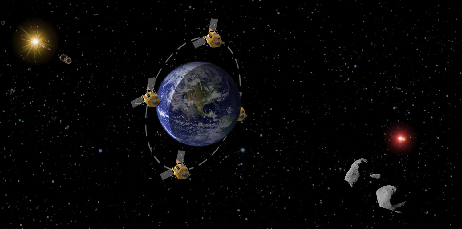
The ALISIO-1 satellite
ALISIO-1 will be the first Canary Islands satellite for Earth Observation. It will host a DRAGO camera and a laser optical communications module for the transmission of data to the ground. This satellite will be launched to space next year 2024, with the collaboration of Deimos, Open Cosmos and D-Orbit.

You can find more information about the ALISIO-1 satellite here:
Acknowledgements: IACTEC-Space has the financial support of the Programa de Capacitación within the TFINNOVA program, the Marco Estratégico de Desarrollo Insular (MEDI), the Fondo de Desarrollo de Canarias and FEDER funds through the Spanish Centro para el Desarrollo Tecnológico y la Innovación (CDTI). IACTEC has the support of Cabildo Insular de Tenerife and the Next Generation EU funds through the Plan de Recuperación, Transformación y Resiliencia of the Spanish government.
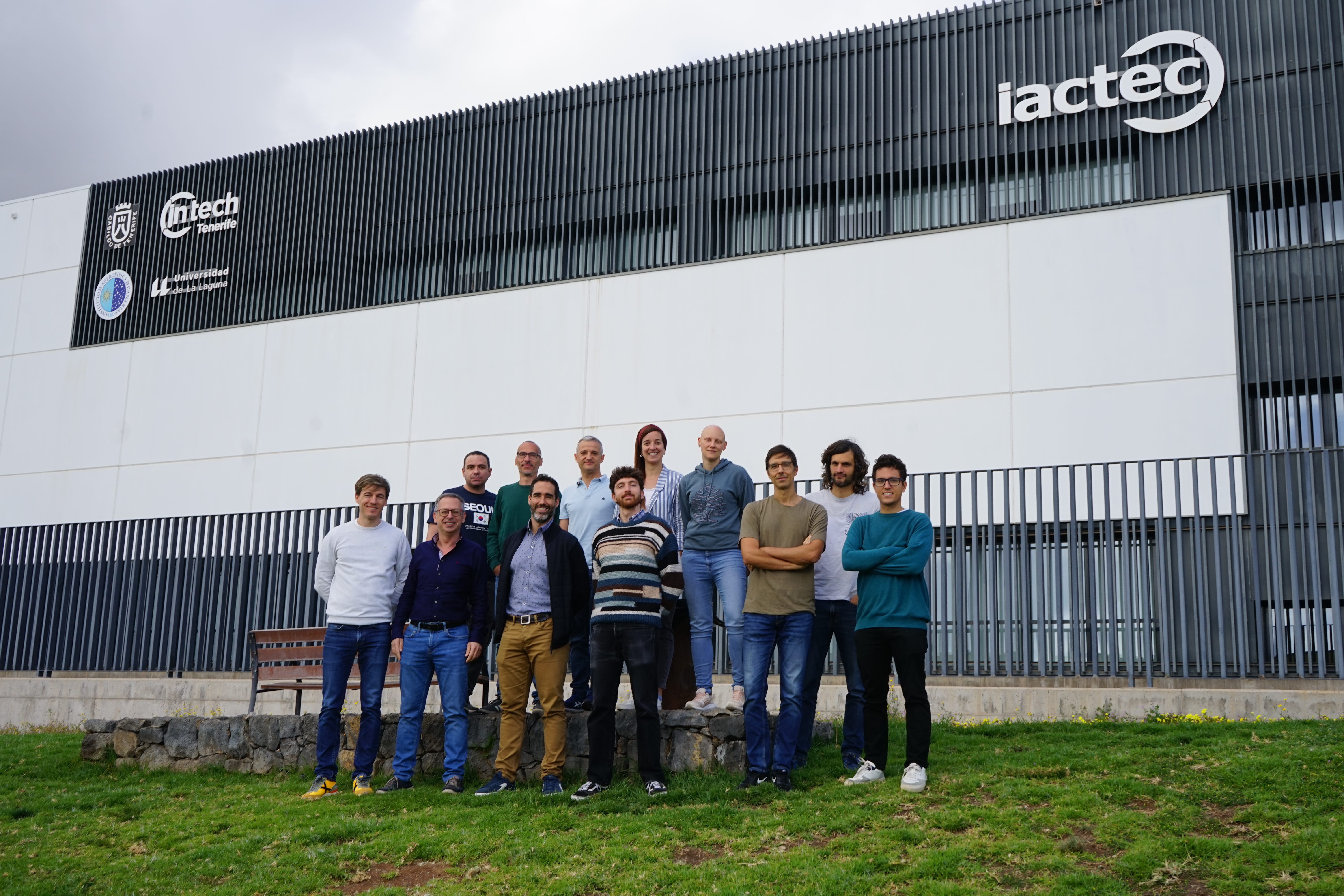
Meet the IACTEC-Space team
We are a small team doing big things. Led by our Principal Investigator, Álex Oscoz, the team is integrated by 15 physicists and engineers who are passionate about space.
If you want to follow our activities, results and latest developments, you can also find us in our social media accounts:
- Instagram: iactec.space
- Linkedin: IACTEC Space
- Facebook: IACTEC-Space
In this video you can get to know a bit more about our team and our current projects. Make sure to activate the English subtitles on the options.
Members
Results
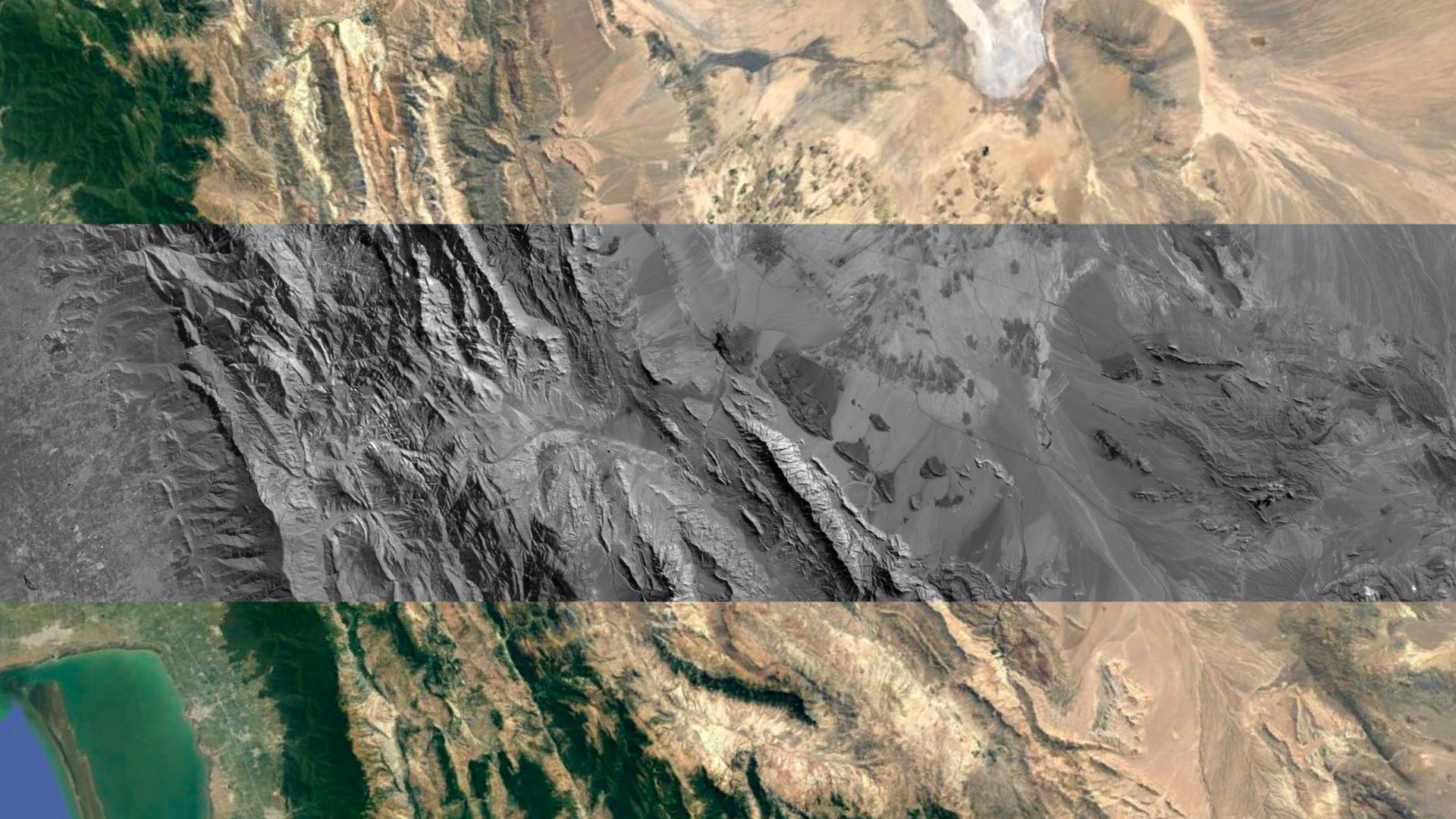
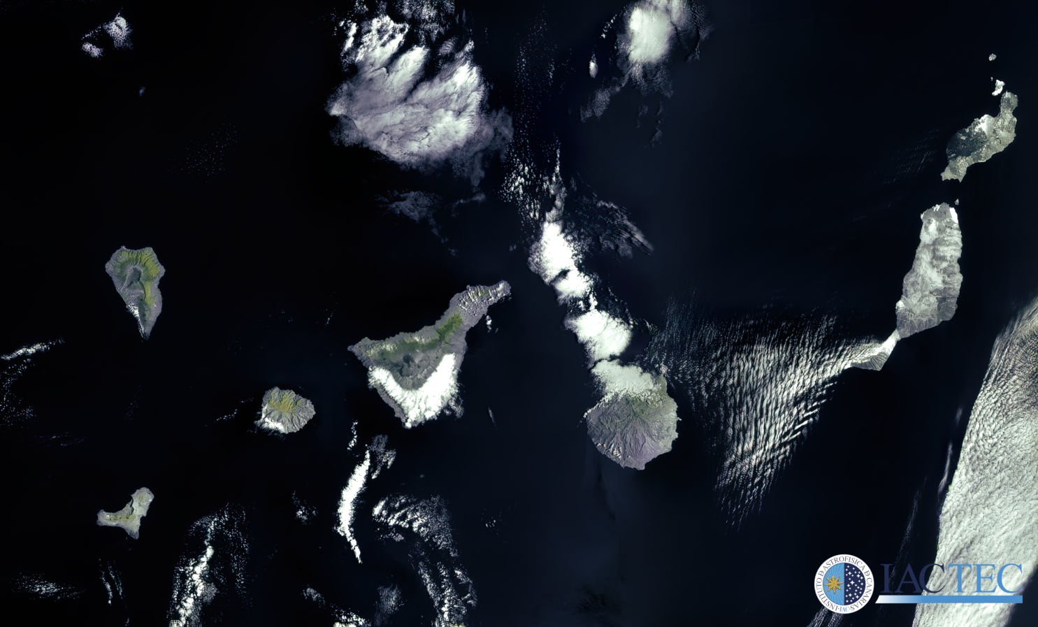
DRAGO imagery
DRAGO-2
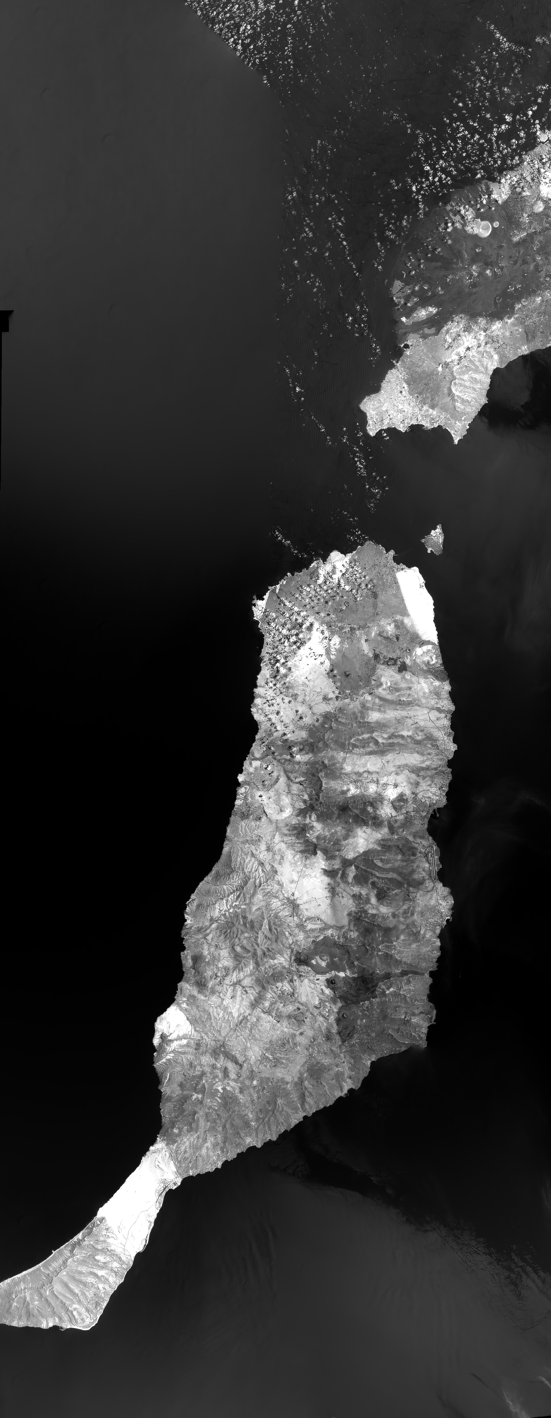
- You can find more images taken by DRAGO-2 from space in our multimedia repository.
- First images of DRAGO-2 from space [VIDEO]
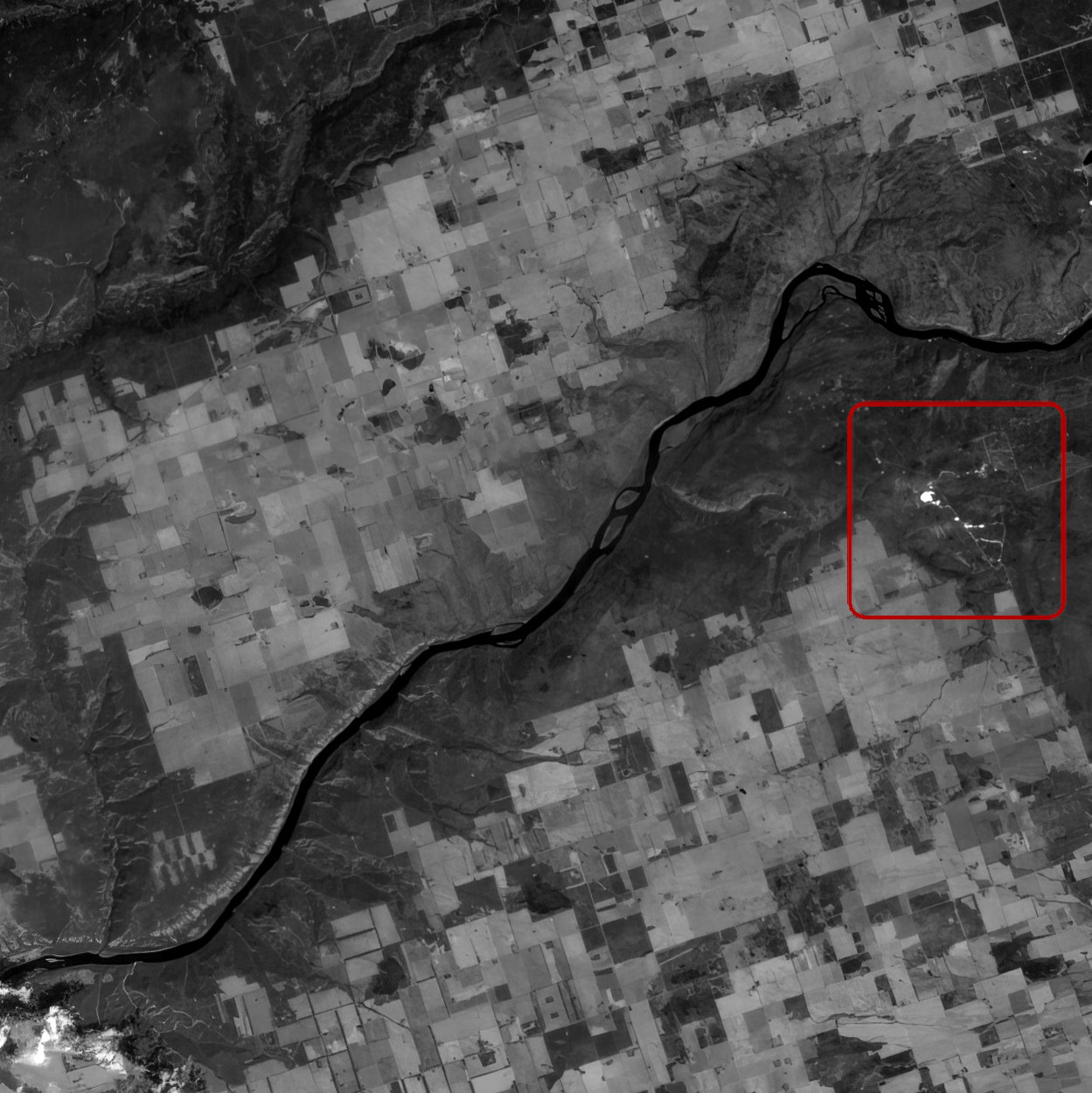
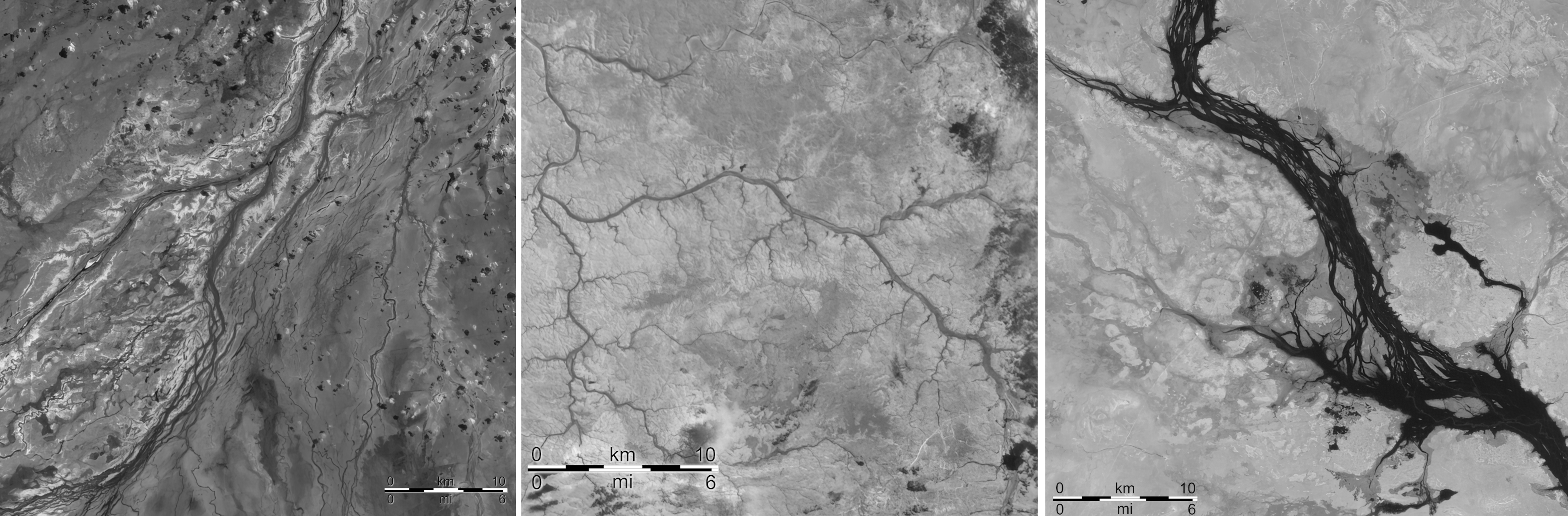
DRAGO-1
Wild-fire monitoring
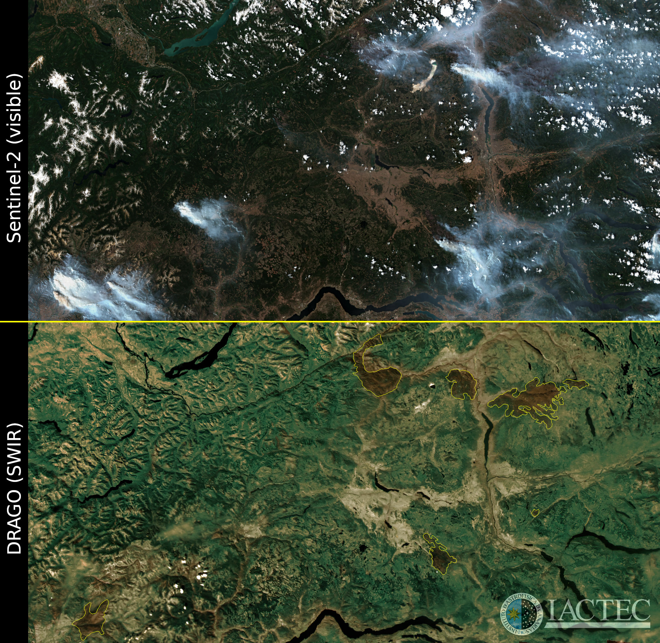
Volcano eruption control
Wide-field mapping
Desertification monitoring

Scientific activity
Related publications
No related publications were found.Related talks
No related talks were found.Related conferences
No related conferences were found.News


")